

Cold again this morning. No wind was at least some relief — but walking, my ears chilled and I covered them with gloved hands till I reached the station.
Last week's snow has nearly vanished downtown, but temperatures dropped further this week: a low of −2.6°C on the 25th, this winter's worst, followed on the 26th at 5:19 a.m. by −1.3°C — second coldest, about 2° below normal.
Wondering about the Imperial Palace moat, I walked from Ōtemachi.
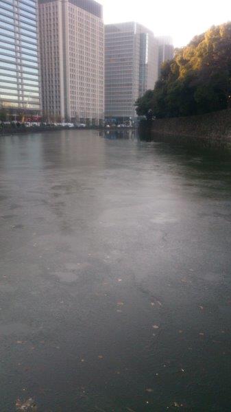
There it was — ice. From the Tokyo Fire Department corner onto Uchibori-dōri, crossing at the signal before the JMA, Ōte-bori ahead was mostly frozen — perhaps 80 percent. Photo lower left faces Ōte-mon. Around 7:25, near the Wake no Kiyomaro statue, Palaceside Building looked as in photo above: mostly frozen with a patch of open water mid-left — bleak and cold.
This cold comes from the Arctic Oscillation overlapping with a meandering jet stream. The “Arctic Oscillation” — pooling and release of polar cold — has become better known in recent years. Pressure is involved, but many factors make prediction hard. When the cold tap turns on, air sinks south to the Japanese archipelago; combined with jet meandering, temperatures plunged improbably far — Okinawa snow, snow in Nagasaki and Kagoshima. Truly surprising weather.
This winter was called mild for El Niño, and it was warm through New Year, but colder air overwhelmed that; experts still mostly expect El Niño’s warm tendency to hold.
The cold lasts through the 26th. Afternoon brings southerly wind and highs around 9°C; the 27th and 28th should warm further — for now, what a relief. (´-`;)